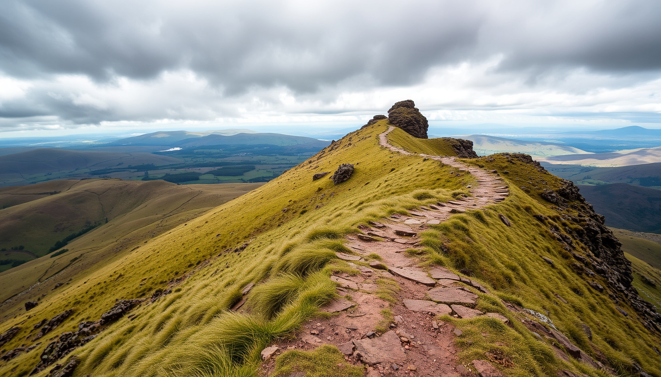
If you’ve driven through the Hope Valley and spotted a jagged hill that seems to crumble into its own shadow, that’s Mam Tor — the Shivering Mountain. Its constant landslides make it both a geological spectacle and one of the Peak District’s most popular walking destinations; here you’ll find practical route details, parking realities, and the fascinating backstory to plan your visit.
Height: 517 m (1,696 ft) · Location: Near Castleton, Derbyshire · Name meaning: Mother hill · Circular walk distance: 3 miles (4.8 km) from Castleton · Famous for: Landslip (Shivering Mountain)
Quick snapshot
- Height: 517 m (1,696 ft) (Wikipedia (the free encyclopedia))
- Location: Near Castleton, Derbyshire (National Trust (conservation charity))
- Name meaning: Mother hill (Wikipedia (the free encyclopedia))
- Famous for: Landslips (Shivering Mountain) (National Trust (conservation charity))
- Circular walk from Castleton: 3 miles (4.8 km) (Wikipedia (the free encyclopedia))
- Longer circular from Hayfield: 5.2 miles (8.4 km) (Countryfile (outdoor magazine))
- Paved path to summit (Wikipedia (the free encyclopedia))
- Moderate difficulty, suitable for most fitness levels (Northern Rail (rail authority))
- Park at Mam Tor car park or in Castleton (Peak Places (local guide))
- Best visited at sunrise or sunset for dramatic light (Peak Places (local guide))
- Wear sturdy footwear; weather can change quickly (Met Office (UK weather service))
- Dogs welcome on lead (National Trust (conservation charity))
- Unstable shale causes frequent landslides (British Geological Survey (UK research agency))
- Nickname ‘Shivering Mountain’ from landslips (British Geological Survey (UK research agency))
- Mam Tor means ‘mother hill’ in Old English (Wikipedia (the free encyclopedia))
- Part of the Carboniferous Millstone Grit (British Geological Survey (UK research agency))
Five key facts, one quick reference:
| Label | Value |
|---|---|
| Height | 517 m (1,696 ft) |
| Location | Castleton, High Peak, Derbyshire |
| Grid reference | SK 127 836 |
| Meaning of name | Mother hill |
| Notable feature | Large landslip on eastern face |
Can you walk Mam Tor from Castleton?
Starting from Castleton
Yes, the walk from Castleton to Mam Tor is a classic Peak District route. The National Trust (the conservation charity that manages the site) recommends starting from the village of Castleton and heading up via the paved path. You can also begin at the Mam Nick car park if you’re coming by car.
Route and distance
- The direct path from Castleton to the summit is about 1.5 miles one way, making the full circular walk approximately 3 miles (4.8 km), according to Wikipedia (the free encyclopedia).
- Longer variations exist: Countryfile (outdoor magazine) details an 8.8‑mile route that takes in the ridge and nearby peaks.
- A Northern Rail (train operator) walk sheet lists a 4‑mile version suitable for a half‑day outing.
Difficulty and terrain
The climb is moderate — the path is paved in sections, making it manageable for walkers of most fitness levels, though steep in places. Northern Rail (train operator) rates it as a “moderate” walk with a minimum time of 3 hours for the longer circuit. Sturdy footwear is essential, especially after rain when the shale can be slippery. For cold-weather preparation, check our guide to best winter jackets for hill walking.
The Mam Nick car park holds very few vehicles. National Trust (conservation charity) explicitly warns drivers to “return later or find an alternative” if it’s full — not a suggestion, a practical reality on busy weekends.
What this means: The Castleton approach gives you a straightforward, repeatable route with a paved final section. It’s the most accessible way to bag the summit without needing a dedicated mountain day.
Why is Mam Tor called the Shivering Mountain?
Geological cause
The nickname comes from the hill’s constant landslides. Mam Tor is built on layers of unstable shale and gritstone — the shale weathers and weakens, causing the eastern face to slump repeatedly. The British Geological Survey (the UK’s leading earth science research body) notes that the landslide complex is one of the most active in the country, with movement recorded for centuries.
History of landslides
- Major slips have been documented as far back as the 18th century.
- The A625 road that once ran over the hill was permanently closed after repeated damage; it now terminates at the landslide scar.
- The instability actually creates the dramatic stepped topography visible from the Hope Valley.
Mam Tor meaning
The name itself is Old English: “mam” means mother, and “tor” means hill — so Mam Tor is literally “mother hill.” Wikipedia (the free encyclopedia) confirms this etymology, adding that it’s a common Celtic place-name element in the region.
The very thing that makes Mam Tor look so dramatic — that crumbling, layered eastern face — is also what gives walkers a front‑row view of active geology. You’re not just hiking a hill; you’re walking on a slow‑motion natural event.
The catch: The same instability that makes the landscape photogenic also means the summit edge and certain paths can shift. Stick to the main trail.
How tall is Mam Tor?
Height in meters and feet
Mam Tor stands at 517 metres (1,696 feet) above sea level, according to Wikipedia (the free encyclopedia). That makes it a “Marilyn” (a hill with at least 150 metres of prominence) and one of the higher points in the Dark Peak area.
Comparison to other Peak District peaks
- By contrast, Kinder Scout (the highest point in the Peak District) reaches 636 m (2,087 ft).
- Mam Tor’s neighbour, Lose Hill, is 476 m (1,562 ft).
- So Mam Tor isn’t the tallest, but its position at the edge of the Hope Valley gives it huge visual impact — you can see it for miles.
What this means: At 517 m, Mam Tor is tall enough to offer panoramic views of the Edale Valley, Kinder Scout, and the Cheshire Plain, but low enough that a fit walker can summit from Castleton in under an hour.
How long is the Mam Tor circular walk?
Route options
The classic circular walk from Castleton is 3 miles (4.8 km) and takes most walkers 1.5 to 2 hours at a steady pace, per Wikipedia (the free encyclopedia). For those wanting more, Countryfile offers an 8.8‑mile (14.2 km) route with 489 m of ascent, taking 5–6 hours, which loops around the back of the ridge. The Northern Rail (train operator) walk sheet describes a 4‑mile (6.4 km) option with a minimum time of 3 hours.
Circular walk details
- Start: Castleton village or Mam Nick car park.
- Ascent: roughly 285 m (935 ft).
- Terrain: paved path to summit, then grassy descent via the ridge or Old Mam Tor Road.
- Navigation: straightforward — the path is well‑marked, but a map (OS Explorer OL1) helps for the longer routes.
Time needed
For the short circular, 1.5–2 hours walking time plus stops for photos and a picnic. For longer loops, plan 3–6 hours. The Met Office (UK national weather service) advises checking the forecast before setting out; wind speeds on the ridge can be 15–20 mph stronger than in the valley.
The pattern: Most visitors stick to the 3‑mile loop — it gives you the summit, the landslide panorama, and a gentle descent without needing an entire day. The longer routes are for walkers who want to link Mam Tor with other peaks like Lose Hill or Back Tor.
Is there parking at Mam Tor?
Parking locations
The closest parking is the Mam Tor National Trust car park (postcode S33 8WA), located at the bottom of the hill just off the main road. National Trust (the land manager) warns that it is “very small” — just a few dozen spaces — and advises arriving early or having a back‑up plan.
Cost and availability
- Parking at the Mam Tor car park is free for National Trust members; non‑members pay via the JustPark app or PayByPhone. Peak District Kids (family walking guide) reports typical rates of £4.50 for up to 4 hours and £6 for over 4 hours.
- Alternatively, the Castleton Visitor Centre car park (S33 8WH) charges £4 up to 4 hours and £6 up to 10 hours, according to Kitti Around the World (travel guide).
Alternative parking
- Castleton Coach/Car Park next to Castleton Garage on Buxton Road: £1.60 up to 1 hour, £7 for 24 hours (Zoe Goes Places (travel blog)).
- Free parking is available further out the village along Old Mam Tor Road (Peak Places (local guide)).
Parking at the Mam Tor car park saves you the walk from the village but fills by 9 a.m. on weekends. Castleton parking is more plentiful but adds about a mile of road walking to your total distance. Choose based on whether you’d rather queue for a space or enjoy a warm‑up stroll.
The pattern: Parking is the single biggest friction point for a spontaneous visit. The smart move: park in Castleton by 9 a.m., walk the circular, and save the stress.
What we know and what’s unclear
Confirmed facts
- Mam Tor is 517 m high (Wikipedia (the free encyclopedia)).
- Its name means ‘mother hill’ (Wikipedia (the free encyclopedia)).
- It is located near Castleton in the Peak District (National Trust (conservation charity)).
- The circular walk from Castleton is approximately 3 miles (Wikipedia (the free encyclopedia)).
What’s unclear
- Exact number of annual visitors is not published.
- Precise length of all walk variations may vary by route.
- Future landslip activity is unpredictable (British Geological Survey (UK research agency)).
What the authorities say
“The Mam Tor circular walk offers spectacular views across the Hope Valley and is a great introduction to the Peak District landscape.”
— National Trust (conservation charity)
“The name Mam Tor is Old English for ‘mother hill’, reflecting its prominence in the local landscape.”
— Wikipedia (the free encyclopedia)
“The site has one of the most extensively monitored landslides in the UK, with movement recorded over many decades.”
— British Geological Survey (UK research agency)
The through line: Whether you come for the geology, the view, or the simple pleasure of a hill walk, Mam Tor delivers a tangible connection to the forces that shaped the Peak District. The National Trust manages it as a recreational asset, but nature remains the lead author of this landscape.
footstepsontheglobe.com, lifehop.co.uk, livingwiththewolf.co.uk, thewanderingwildflower.co.uk, letsgopeakdistrict.co.uk
Frequently asked questions
What is the best time to visit Mam Tor?
Sunrise and sunset offer the best light for photography and fewer crowds. Spring and autumn provide the most comfortable walking temperatures.
Are dogs allowed on Mam Tor?
Yes, dogs are welcome on leads. The National Trust requests that owners keep dogs under control, especially near livestock and the cliff edges.
How difficult is the Mam Tor walk?
Moderate. The path is paved in sections but steep in places. Most fit walkers can complete the 3-mile circular in 1.5–2 hours.
Is Mam Tor free to access?
The hill itself is free. Parking at the National Trust car park is free for members; non-members pay a small fee. Parking in Castleton also incurs charges.
What should I wear for walking Mam Tor?
Sturdy walking shoes or boots are essential. The weather can change quickly; bring waterproofs and a warm layer even in summer. A good waterproof jacket like those in our winter coats guide is recommended.
Can I cycle on Mam Tor?
Cycling is permitted on the paved path, but the steep gradient and foot traffic make it challenging. Mountain bikes are better suited to the surrounding trails.
Are there toilets at Mam Tor car park?
No, there are no public toilets at the car park. The nearest facilities are in Castleton village.
Mam Tor is a rare hill that rewards visitors with both a satisfying walk and a front-row seat to ongoing geological change. The same landslides that earned it the nickname “Shivering Mountain” have created one of the most dramatic viewpoints in the Peak District. For anyone planning a day out from Castleton, the equation is simple: start early, park smart, and let the ridge do the rest. Walkers who come prepared will find the view across the Hope Valley — framed by the crumbling eastern edge — more than worth the effort.

George Thompson is Senior Reporter at UrbanMixr.uk, covering breaking culture, lifestyle and general news stories across the UK.