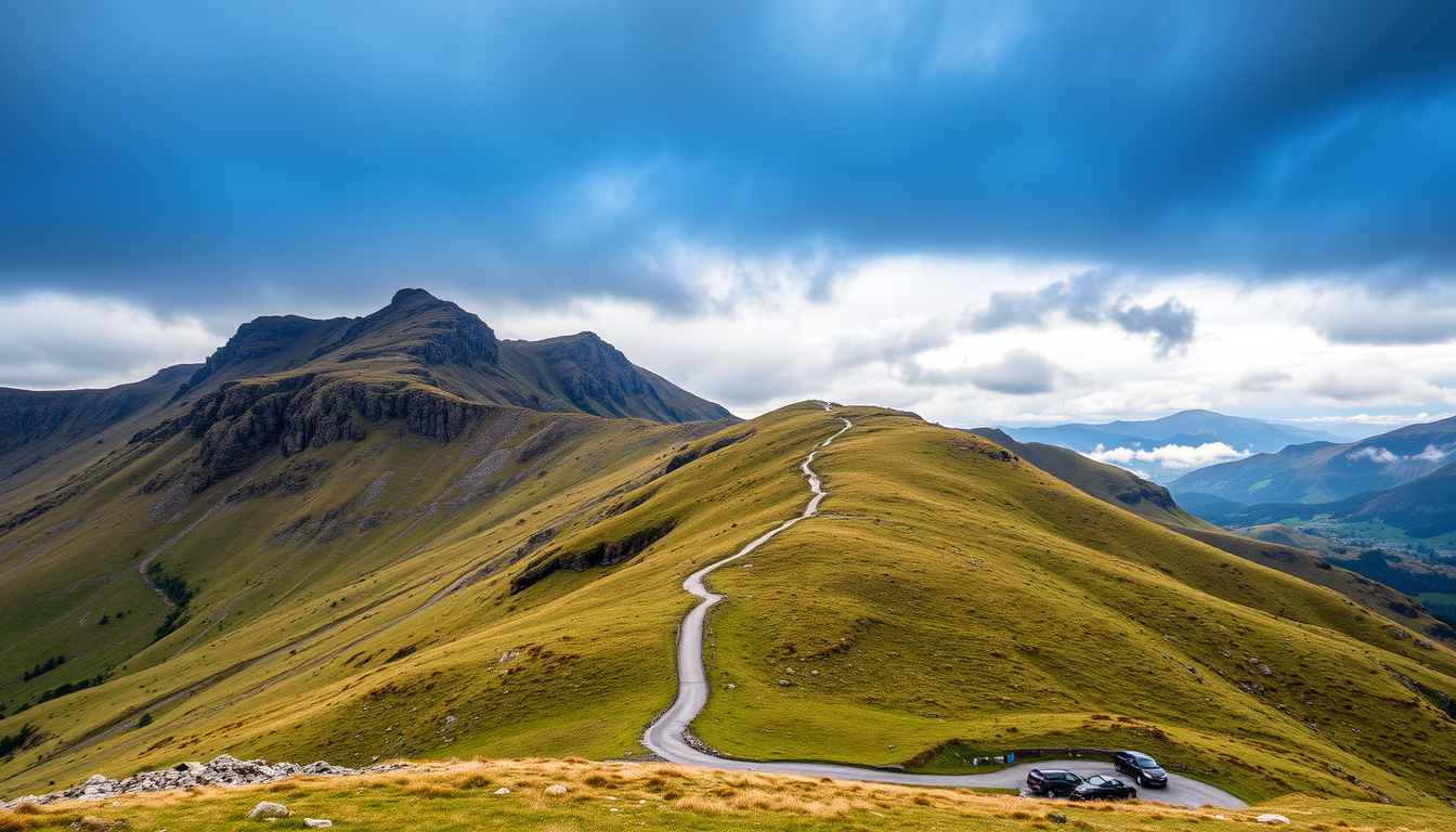
Plenty of drivers on the A487 between Dolgellau and Machynlleth have looked up at Cadair Idris and wondered whether they can actually walk it — they can, and the real planning question is not the height but the route. At 893 m (2,930 ft), the summit of Penygadair asks for a full day, and the path you pick decides how steep, how long and how busy the day feels (Visit Mid Wales (regional tourism board)); what follows sorts the four choices that matter: path, parking, time and weather.
Height: 893 m (2,930 ft) · Summit: Penygadair · Location: Southern end of Snowdonia National Park (Eryri), near Dolgellau · Named routes: Pony Path and Minffordd Path · Area: Meirionnydd, Gwynedd, Wales
Quick snapshot
- Cadair Idris is 893 m (2,930 ft) high; the summit is Penygadair (Visit Mid Wales (regional tourism board)) (Natural Resources Wales (official reserve managers))
- Minffordd Path: about 9 km return, 788 m of ascent, roughly five hours, starting at Dôl Idris car park (Natural Resources Wales (official reserve managers))
- Pony Path: about 10 km return, 727 m of ascent, roughly five hours (Visit Snowdonia (walking routes information))
- The mountain sits at the southern end of Snowdonia National Park (Eryri), in Meirionnydd, Gwynedd (Wikipedia (Cadair Idris reference entry))
- Which car parks will have spaces on a busy weekend
- Which route is easiest for your particular fitness and experience
- Current weather and ground conditions at the summit
- Whether facilities near the route starts are open when you visit
- Plan a full day: parking, summit time and descent all sit on top of the walking time
- Dôl Idris car park charges a fee, and the parkland circuit beside it takes about 30 minutes (Natural Resources Wales (official reserve managers))
- No advance-booking system is listed for the mountain’s main car park
- Main route descriptions quote five-hour returns before breaks are added
- Choose your route by start point and parking before you set off
- Check the mountain forecast and current site information from Natural Resources Wales
- Decide between the full summit day and the accessible parkland circuit
- Weigh Snowdon’s route choice and booking rules against Cadair’s quieter start
Six facts, one theme: Cadair Idris is a serious mountain whose useful dimensions — height, summit, area and the two routes everyone names — are the numbers that shape a five-hour day.
| Label | Value |
|---|---|
| Height | 893 m (2,930 ft) |
| Summit | Penygadair |
| Area | Meirionnydd, Gwynedd, Wales (Wikipedia (Cadair Idris reference entry)) |
| National park | Snowdonia National Park (Eryri) — southern end |
| Main route named in sources | Minffordd Path |
| Route named in related searches | Pony Path (Visit Snowdonia (walking routes information)) |
Is Cadair Idris a difficult climb?
The official route descriptions do not sugar-coat it. Visit Mid Wales grades the summit routes as hard or strenuous mountain walks, with an expected return of roughly five to six hours (Visit Mid Wales (regional tourism board)).
The word “hard” applies to the walk, not the height. At 893 m (2,930 ft), Cadair Idris is not a technical peak; the effort comes from sustained climbing, open ground and the mountain’s own weather, which can change a clear morning into a navigation day by early afternoon.
The numbers that decide difficulty are the ascent and the time on your feet, not the height: 788 m of climbing inside a roughly 9 km return walk means a day-long effort on the Minffordd Path, with the weather holding the final vote.
How hard is the Minffordd Path?
- Distance: about 9 km return
- Ascent: 788 m
- Return time: about five hours
- Grading: hard or strenuous in official tourism materials
Seven hundred and eighty-eight metres of ascent across a roughly 9 km return route works out to continuous climbing for most of the walk, not a few steep steps near the top. Natural Resources Wales, which manages the reserve, treats the Minffordd Path as the principal summit route from Dôl Idris, and the five-hour figure assumes steady walking rather than a fast push.
In practical terms, the Minffordd Path is the route people mean when they say Cadair Idris is “a proper day”. The climb is long, the descent is hard on the knees, and the summit is an exposed place to stop, so the difficulty of the day tracks the weather forecast as much as the path itself.
Do you need hiking experience on Cadair Idris?
- No technical climbing is mentioned in the official route descriptions
- Navigation experience matters when cloud drops over the summit
- Hill fitness matters more than gear on the way up
- Weather judgment decides whether you turn around at the right time
If you can walk for five hours on steep ground, you can attempt the route; whether you finish in good conditions is a separate question. The reserve’s own information is plain about what the day involves: a mountain path that climbs from a public car park to a summit at 893 m (2,930 ft), exposed to whatever weather arrives. First-time hill walkers should not be put off by the grade, but they should treat the five-hour figure as the best case, not the plan.
Is Cadair Idris harder than Snowdon?
Snowdon holds the altitude advantage; Cadair Idris holds the quieter start. Snowdon, also called Yr Wyddfa, tops out at 1,085 m (3,560 ft) and sends its main trails out from Llanberis, Pen-y-Pass, Pont Bethania, Rhyd Ddu and Llyn Cwellyn, according to Snowdon Hike (independent walking guide). Cadair Idris answers with 893 m (2,930 ft), but the number that matters is not the 192 m gap between them — it is how you start, where you park and how much of your energy goes into logistics.
Walkers trade 192 m of altitude for a simpler day on Cadair Idris: the official route information points to one charged car park with no booking scramble, while Snowdon’s busiest trailhead, Pen-y-Pass, can demand an advance booking on weekends and bank holidays.
Which mountain is taller, Cadair Idris or Snowdon?
Cadair Idris: 893 m (2,930 ft) · Snowdon (Yr Wyddfa): 1,085 m (3,560 ft) · Difference: 192 m
- Snowdon is the taller mountain by 192 m
- Cadair Idris is the taller test of route planning, because it offers fewer start points
- Height alone never decides how hard a walk feels; gradient, ground, distance and weather do
Altitude is the easiest number to compare and the least useful one for planning. Snowdon’s extra 192 m stretches the day slightly, but the character of both mountains comes from the same Welsh mountain weather and the same long, steep approaches.
The pattern: if you are choosing between the two purely on difficulty, height is the worst number on the page — the practical arrangements are what separates a great day from a grind.
How do ascent and route length compare?
- Minffordd Path, Cadair Idris: about 9 km return with 788 m of ascent
- Pony Path, Cadair Idris: about 10 km return with 727 m of ascent
- Snowdon: multiple trailheads, so ascent and distance vary with the route you choose
- Cadair Idris’s main routes: about five hours in their official descriptions
The honest comparison is that both mountains ask for a long day on steep ground; the difference is that Snowdon spreads the load across more route choices, bus links and several villages, while Cadair Idris concentrates its named routes into two well-known lines from its southern side. That makes Snowdon more flexible and Cadair Idris more straightforward — which one feels “harder” depends on whether you hate parking or hate repetition.
The catch: Snowdon’s extra 192 m, extra crowds and booking rules can make it the harder logistical day, even when the walking itself feels similar to Cadair Idris.
The pattern: Cadair Idris trades Snowdon’s extra altitude and route choice for a quieter, less constrained day — which one is harder depends on whether you prefer crowds or distance.
How long does it take to walk up Cadair Idris?
Plan for five hours of walking and a whole day out. Both of the main named routes carry a five-hour return figure in their route descriptions, and neither figure includes parking, summit breaks, food stops, photos or the extra minutes that wet rock and wind add to a descent.
Mountain time runs slower than valley time. On a warm, still day the official estimates hold; on a windy or icy day, the same ground can take an hour longer, and the smart plan builds that hour into the schedule before anyone sets out.
What is the distance via the Pony Path?
- Start: Tŷ Nant
- Distance: about 10 km return
- Ascent: 727 m
- Return time: about five hours (Visit Snowdonia (walking routes information))
The Pony Path is the longer of the two main options and the one that starts from Tŷ Nant. Ten kilometres return sounds modest by road-walking standards; with 727 m of ascent inside it, the same distance becomes a full morning and afternoon of steady work.
Because the Pony Path spreads its climbing over a longer distance, it tends to feel less relentless than the Minffordd Path, which is worth knowing if your knees prefer a gentler gradient to a shorter day.
What is the distance via the Minffordd Path?
- Start: Dôl Idris car park, near the A487/B4405 junction
- Distance: about 9 km return
- Ascent: 788 m
- Return time: about five hours
The Minffordd Path is the shorter route by distance and the steeper one by gradient: 788 m of ascent squeezed into about 9 km returns a harder average pull than the Pony Path’s 727 m over 10 km. In practice the clocks end up close, and the weather holds the last word on the summit.
Whichever path you choose, add at least an hour to the five-hour figure for the full day: parking, booting up, summit photos, lunch and the slow, careful descent on tired legs.
What is the easiest path to walk up Cadair Idris?
“Easy” is a relative word on an 893 m mountain. If the goal is the least demanding day that still reaches the top, pick the route with the gentler average gradient and the start point that causes the least morning stress — because a five-hour walk that begins with a stressful drive is not the easy option.
How does the Pony Path compare with the Minffordd Path?
- Pony Path: 727 m of ascent spread over about 10 km return (Visit Snowdonia (walking routes information))
- Minffordd Path: 788 m of ascent over about 9 km return
- Return time on both: about five hours in the official route descriptions
- Easiest on paper: the Pony Path’s gentler gradient, bought with one extra kilometre each way
The arithmetic is simple: 727 divided by 10 is a gentler average climb than 788 divided by 9, so the Pony Path’s longer distance buys a kinder slope. The word “average” does a lot of work, though — the Pony Path still has its steep sections, and a windy day on the top makes either route feel hard.
The easiest Cadair Idris is the one you can reach calmly: the Pony Path from Tŷ Nant if you want the gentler pull, the Minffordd Path from Dôl Idris if you want the shorter day, and the 30-minute parkland circuit if the summit can wait for better weather.
Where does the Minffordd Path start?
- Car park: Dôl Idris, the principal access point for the route
- Road: the B4405, just off the A487 between Dolgellau and Machynlleth
- Facilities: the car park also serves an accessible parkland circuit
- Parking charge: yes
Natural Resources Wales names the Minffordd Path as the summit route from the reserve, which makes Dôl Idris the most documented starting point on the mountain. If you want the shortest official line to Penygadair and a car park you can find without a second thought, this is the route to plan around.
Where to park to climb Cadair Idris?
Parking is the quiet reason walkers pick Cadair Idris over Snowdon. The main summit routes start from two known points, and the practical result is simpler, less constrained parking than Snowdon’s headline trailheads.
- Pen-y-Pass (start of the Pyg Track and Miners’ Track): advance booking required on weekends and bank holidays, approximately March to November (Visit Snowdon (Snowdon visitor guide))
- Llanberis village car parks (Llanberis Path): generally no advance booking (Visit Snowdon (Snowdon visitor guide))
- Watkin Path at Pont Bethania: parking described as extremely limited (Snowdon Hike (independent walking guide))
- Rhyd Ddu and Snowdon Ranger routes: parking at Rhyd Ddu station and Llyn Cwellyn, with the Sherpa’r Wyddfa bus linking access points and park-and-ride at Nant Peris (Snowdon Hike (independent walking guide))
Cadair Idris runs the quieter playbook. The official information lists no booking system for its main car park, which removes one of the most common reasons Snowdon plans fall apart before the walk starts.
Is there parking at the Minffordd path?
- Yes — Dôl Idris is the principal access point and the car park charges a fee (Natural Resources Wales (official reserve managers))
- Position: reached from the B4405, just off the A487 between Dolgellau and Machynlleth
- Extra: the site includes an accessible parkland circuit of about 0.9 km, roughly 30 minutes
- Capacity: check current conditions before setting out, and treat busy weekends as a reason to arrive early
Natural Resources Wales treats Dôl Idris as the base of the reserve and the start of the Minffordd summit route, so the car park does double duty: it serves the five-hour climb and the 30-minute parkland loop in the same visit.
What should I know before parking near Dolgellau?
- Dolgellau is the nearest town named on the access routes; use it for fuel, food and final checks
- The Pony Path’s start at Tŷ Nant is a separate parking decision, not an alternative to Dôl Idris
- Popular weekends fill the small car parks early, so the mountain rewards people who arrive before mid-morning
- If the car park is full when you arrive, do not block the approach road; turn back and choose a quieter day
The pattern: Cadair Idris’s parking problem is a morning problem, not a booking problem. Solve it by arriving early, and you remove the main source of stress on the day.
The implication: parking is the first decision of the day, and getting it right removes the main source of friction before the walk begins.
What are some good walks around Cadair Idris?
Cadair Idris is not a one-route mountain. The tourism and reserve pages point to three commonly recommended summit routes — the Minffordd Path, the Pony Path and the Llanfihangel y Pennant Path — plus a short accessible circuit that makes the site work for non-summit days (Visit Mid Wales (regional tourism board)).
Which routes go up Cadair Idris?
- Minffordd Path — from Dôl Idris car park, about 9 km return with 788 m of ascent
- Pony Path — from Tŷ Nant, about 10 km return with 727 m of ascent
- Llanfihangel y Pennant Path — the third commonly cited line, with its own start point and parking questions
- Dôl Idris parkland circuit — 0.9 km, about 30 minutes, graded accessible
The first two carry the weight of most planning, which is why the daily decision comes down to Dôl Idris versus Tŷ Nant. The third route is the one to research separately: the materials we used name it without giving it a distance, time or parking arrangement, so treat it as an option to investigate rather than a default plan.
What is the Pony Path on Cadair Idris?
- Start: Tŷ Nant
- Distance: about 10 km return
- Ascent: 727 m
- Return time: about five hours
- Character: the longer, slightly gentler line to Penygadair
The Pony Path is the route you choose when the arithmetic matters: the same five-hour estimate as the Minffordd Path, a longer distance and a softer average gradient, all starting from Tŷ Nant. For a different kind of day, the Dôl Idris parkland circuit turns the same car park into a 30-minute family walk with the mountain as scenery rather than the objective — a sound plan for groups where not everyone wants the summit.
Where can I get a map of Cadair Idris?
- Start with the Natural Resources Wales page for the reserve, which names the routes, the car park and the access road
- Use a detailed walking map of the southern Snowdonia (Eryri) area for the summit routes
- Check the mountain forecast and any site notices before setting out
- Ask at local visitor services in Dolgellau or Machynlleth for current ground conditions
Digital maps are convenient, but the classic advice still holds on an open summit where cloud can arrive quickly: carry a paper map as the backup, keep a compass with it, and know how to use both before you need them.
What this means: the best walk around Cadair Idris is the one matched to your start point, your parking and the forecast — the mountain rewards planners and punishes improvisers in exactly equal measure.
Six rows, one pattern: Cadair Idris and Snowdon are close enough in effort that logistics — parking, route choice, transport — usually decide which day is actually harder.
| Comparison | Cadair Idris | Snowdon (Yr Wyddfa) |
|---|---|---|
| Height | 893 m (2,930 ft) | 1,085 m (3,560 ft) |
| Summit | Penygadair | Yr Wyddfa |
| Named route starts | Dôl Idris (Minffordd Path), Tŷ Nant (Pony Path) | Llanberis, Pen-y-Pass, Pont Bethania, Rhyd Ddu, Llyn Cwellyn |
| Parking model | Dôl Idris: paid, no advance-booking system listed in official information | Pen-y-Pass: advance booking on weekends and bank holidays, approx. March–November; Llanberis: generally no booking |
| Transport links | Car-first access in the official route information | Sherpa’r Wyddfa bus network with park-and-ride at Nant Peris |
| Return time for main routes | About five hours | Varies by route and start point |
The pattern worth remembering: Cadair Idris offers a simpler day with fewer moving parts; Snowdon offers more options and more crowds, and the booking rules are the price of its convenience.
Two lists, one judgment: Cadair Idris trades Snowdon’s crowds and booking rules for a quieter, simpler mountain day — with the same weather, the same long climb and no bus network to fall back on.
Upsides
- Simpler parking than Snowdon’s busiest trailheads: one main charged car park at Dôl Idris serves the Minffordd Path
- Two five-hour route options let you pick your gradient — the Pony Path’s 727 m over about 10 km, or the Minffordd Path’s 788 m over about 9 km
- A genuinely accessible 0.9 km parkland circuit means non-summit walkers can share the day
- Southern Snowdonia (Eryri) location keeps the trailheads quieter than Snowdon’s headline starting points
Downsides
- Summit routes are graded hard or strenuous, with roughly five to six hours as the planning figure
- Car-first access: the official route descriptions point to Dôl Idris and Tŷ Nant, with no bus network listed
- The paid car park shapes your start; if it fills, the plan changes quickly
- An open summit means weather decides the day, and turning back has to be part of the plan
For most walkers, the upsides win: Cadair Idris delivers a serious mountain day with fewer logistical traps than Snowdon, provided the forecast is treated as part of the route.
Plan the walk in six steps
Every decision on this list is reversible except the one you make halfway up: set your turn-back conditions before you leave the car park, not after the cloud arrives.
- Pick your summit route by start point: Minffordd Path from Dôl Idris, or Pony Path from Tŷ Nant.
- Check the parking basics: Dôl Idris is the principal access point for the Minffordd Path and charges a fee; the Pony Path starts from Tŷ Nant.
- Check the mountain forecast and any current site information from Natural Resources Wales before driving out.
- Pack for a five-hour mountain day: map, compass, waterproofs, layers, food, water and a headtorch.
- Tell someone your route and your planned return time.
- Set your turn-back conditions in advance — time, weather change, fatigue — and treat them as binding.
The intention behind the list is simple: on Cadair Idris, most problems come from plans that were never written down. A route, a parking plan, a forecast check and a turn-back time turn a hard mountain into a manageable one.
We split the planning facts into two lists: what the sources agree on, and what you still need to check on the day.
Confirmed facts
- Cadair Idris is 893 m (2,930 ft) high, with the summit named Penygadair (Visit Mid Wales (regional tourism board))
- The mountain sits in Meirionnydd, Gwynedd, at the southern end of Snowdonia National Park (Eryri) (Wikipedia (Cadair Idris reference entry))
- The Minffordd Path starts at Dôl Idris car park: about 9 km return, 788 m of ascent, around five hours (Natural Resources Wales (official reserve managers))
- The Pony Path starts at Tŷ Nant: about 10 km return, 727 m of ascent, around five hours (Visit Snowdonia (walking routes information))
- Dôl Idris car park charges a fee and also gives access to a 0.9 km accessible parkland circuit (Natural Resources Wales (official reserve managers))
- Snowdon (Yr Wyddfa) is taller at 1,085 m (3,560 ft) (Snowdon Hike (independent walking guide))
What’s unclear
- Which car parks will have spaces when you arrive on a busy weekend
- Which route is genuinely easiest for your fitness and experience
- Current snow, ice and ground conditions above the car parks
- Whether route-start facilities are open when you visit
- How a specific Snowdon route compares hour-for-hour with Cadair Idris side by side
- Local site conditions after storms — always check Natural Resources Wales before driving out
What the route guides say
Cadair Idris’s summit routes are described as hard or strenuous mountain walks, with an expected return duration of roughly five to six hours.
— Visit Mid Wales (regional tourism board)
The Minffordd summit route starts from the car park at Dôl Idris and is approximately 9 km return, with 788 m of ascent and a return time of about five hours.
— Natural Resources Wales (official reserve managers)
Pen-y-Pass parking must be booked in advance on weekends and bank holidays from approximately March to November, while Llanberis village car parks generally do not require advance booking.
— Visit Snowdon (Snowdon visitor guide)
Making the call
Cadair Idris is the mountain where a good plan feels easy and a bad plan feels dangerous; the difference is rarely fitness, and almost always preparation.
The real test on Cadair Idris is decision quality, not leg speed. Choose the Minffordd Path when you want the shortest official line to Penygadair and can accept the steeper gradient; choose the Pony Path from Tŷ Nant when a gentler average pull matters more than one extra kilometre; and choose the parkland circuit when the summit is not the point of the day. Snowdon is the taller, busier, better-connected sibling, but Cadair Idris punishes a sloppy plan just as quickly. For anyone starting from Dolgellau, the choice is clear: match the route to your start point, parking and time budget, or the mountain will make the decision for you.
Related reading: Grand National horse guide · Nike shoes buying guide
Frequently asked questions
What should I wear to climb Cadair Idris?
Layered clothing, waterproofs and sturdy footwear are the baseline for an 893 m mountain whose routes are graded hard or strenuous. Even on a warm valley morning, the summit can be cooler and windier than Dolgellau, and a five-hour day means you will sweat, chill and sweat again. A hat and gloves take up no space and rescue a cold summit stop.
Are dogs allowed on Cadair Idris?
The official Natural Resources Wales materials we used describe the reserve’s paths and car park but do not set out a dog policy, so check the current guidance before you go. On the steep summit sections a dog on a lead is safer for everyone, and you should carry water for the dog as well as yourself.
Can I climb Cadair Idris in winter?
You can, but winter changes the calculation. The routes keep their five-hour length and roughly 788 m of ascent, then add short daylight, cold wind and possible snow and ice near the summit. If you are not experienced on hard, icy ground in winter conditions, choose a different month; if you do go, treat the forecast as the most important gear you carry.
Do I need a map and compass for Cadair Idris?
Yes for the summit routes. The Minffordd and Pony Paths are clear on a good day, but cloud on the open summit removes the landmarks, and descending paths can look similar in poor visibility. Carry a detailed walking map of the southern Snowdonia (Eryri) area, know how to use it, and keep a compass as the backup that does not need a battery.
What is the best time of year to climb Cadair Idris?
Late spring to early autumn gives the longest daylight and the best odds of stable mountain weather, which is why most route descriptions assume those months. At other times, treat the five-hour return as a best case rather than a promise. Whenever you go, check the forecast, arrive early enough for a calm parking decision at Dôl Idris or Tŷ Nant, and check the current Natural Resources Wales information for the reserve.
Are there toilet or food facilities near Cadair Idris route starts?
The Natural Resources Wales information points to the Dôl Idris car park and its parkland circuit, but it does not list toilets, cafés or food outlets on the site, so plan as if they are not there. Dolgellau and Machynlleth, which sit on either side of the A487 approach to the mountain, are the realistic places to eat, refill water bottles and use facilities before heading up.

George Thompson is Senior Reporter at UrbanMixr.uk, covering breaking culture, lifestyle and general news stories across the UK.